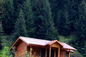
There's nothing more refreshing than a forest hike or a view of the countryside from the top of a mountain! In Aspen Snowmass, the top ski resort in North America, there are many hiking routes crisscrossing the four major snow-capped mountains and the surrounding areas.
Or the flowers are full of flat and easy walks, or the mountains are densely packed with steep and rugged, all guiding visitors to capture Aspen's extraordinary vistas. The 5 most beautiful hiking routes in Aspen, which one do you want to choose?
1. Mountain Route
Popular with locals, this 'in-town' fitness hike is not only a relatively short walk but also offers stunning views of Aspen and the Aspen Mountains.
Difficulty: Moderate
Length of route: 3 miles (to and from Smuggler Lookout)
Elevation Ascent: 800 feet
The starting point of the hiking route: Take Highway 82 (Cooper Street) east out of the city, cross the bridge about 45 meters and turn left into Park Avenue, turn right at the left corner of the street and go up the hill.
2. Ute Hiking Trail
From downtown Aspen, the gently spiraling, steep, and laborious Ute hiking trail is just what aerobics is like. The route leads to a rocky outcrop overlooking Aspen, and the view at the end is certainly worth all the effort on the way.
Difficulty: Difficult
Route Length: 2.4 miles round trip
Elevation Ascent: 1700 feet
The starting point of the hiking trail: Go east on Main Street, turn right onto Original Street, turn left at the end of the road to Ute Avenue, then continue to follow the trail signs, the trail starts opposite the parking lot.
3. Sunnyside Hiking Trail
On the scenic Red Mountain, the Sunnyside Hiking Trail winds it’s way up through sagebrush and cochineal oak, each bend offering a different view. From here there are expansive views of the city of Aspen, the ski areas of Aspen Snowmass Ski Village, and the snow-capped peaks of the Roaring Fork Valley.
The trails are flat and don't require specialized hiking shoes, but be sure to bring a hat and plenty of water as it can get hot here.
Difficulty: Moderate
Route Length: 4.8 miles (round-trip through the woods)
Elevation ascent: 1700 feet (to antenna towers)
Trail Start: Head west on Main Street, turn right on Cemetery Lane and continue 1.1 miles to the parking lot near the Slaughterhouse Bridge, the trail starts across the street.
4. Rim Hiking Trail
The Rim Hiking Trail that winds through Snowmass Village offers views of Brush Creek Valley and sweeping views of the Brown Bells-Snowmass Wilderness. You can hike all or part of the trail, or set off from the southern start to Spiral Point, a gossip-shaped viewing platform with a backdrop of majestic snow-capped peaks.
Difficulty: Moderate
Route length: 7.1 miles one way, 1.3 miles from the southern start to Spiral Point
Elevation Ascent: 1120 feet
South starting point: From Aspen, drive west on Hwy 82 to Brush Creek Road, and turn left for Snowmass Village. Continue on Bush Creek Road for 5.3 miles, and turn right onto Co 10 Road, the starting point will be on your right.
North starting point: From Aspen, drive west on Hwy 82 to Shrub Creek Road, and turn left for Snowmass Village. Continue on Shrub Creek Road for 4 miles, turn right onto Horse Ranch Drive, then left to continue on this road, and finally right at Trail Rider Lane.
5. Capitol Creek Hiking Trail
It's no exaggeration to say that this is an off-the-beaten-path and one of the most scenic routes in Aspen! Once you've driven to the start of the trail, you'll be guided through a beautiful forest of aspen and evergreen trees with stunning views of Capitol Peak. Although the roads are rough and there is no cell phone signal after leaving Highway 82, the scenery is extraordinary!
Difficulty: Capitol Creek Loop – Moderate; Capitol Lake – Hard
Route length: Capitol Creek Loop – 6.6 miles round trip; Capitol Lake Trail – 12.8 miles round trip
Elevation Ascent: Capitol Creek Loop – 1500ft; Capitol Lake Trail – 2105ft
Hiking Trail Start: Drive 14 miles west of Aspen on Hwy 82 to Old Snowmass, and turn left onto Snowmass Creek Road next to the Conoco gas station. Continue for 2 miles to the T-junction, turn right and continue for 5 miles until the end of the sidewalk, and follow the dirt road for about 3 miles to the trailhead.